Google is no longer a young company, and many of its products have been in existence for over two decades. Its "not an April Fools joke" email service turned 21 earlier this year, and now, Google Earth is celebrating its 20th birthday.
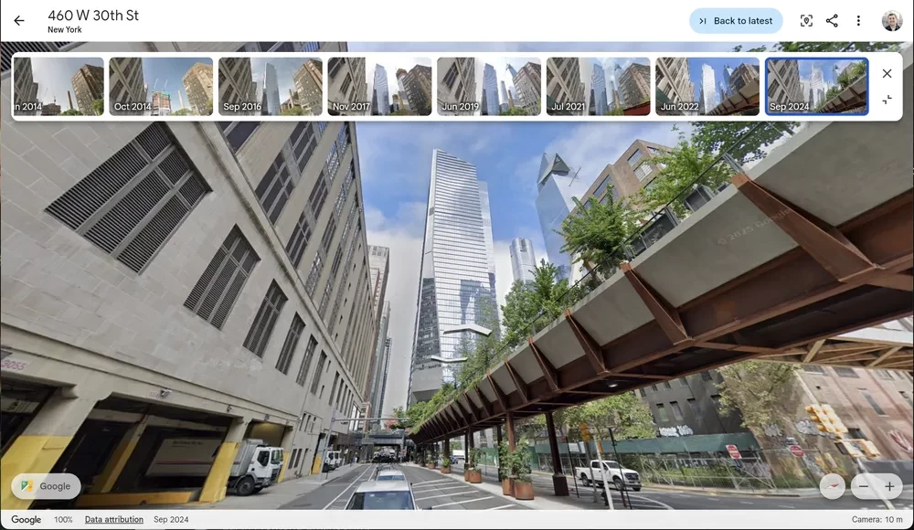
The search giant announced that Google Earth is getting historical Street View imagery to celebrate the milestone. "Now, you can access historical Street View imagery right from Google Earth — and if you use Google Earth in a professional capacity, you can easily access new datasets, like tree canopy coverage for cities, land temperatures and more," Google said in a blog post.
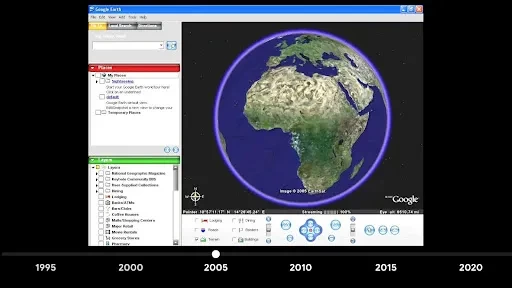
Google Earth is well-known for offering many internet users an interactive bird's-eye view of the world at a time when mapping apps weren't as advanced. It was launched in June 2005 and features 3D buildings across major US cities, integrated local search, and 3D terrains showing mountains, valleys, and canyons around the world.
Users could activate, tilt, and rotate 3D terrain for a different perspective of a location. It was an instant hit after launch, with over 100 million downloads in its first week. Just months later, Google worked with the National Oceanic and Atmospheric Administration (NOAA) to make updated imagery available to first responders battling Hurricane Katrina.
However, the tech that powers Google Earth is a bit older than that. It was initially developed as Earth Viewer by Keyhole Inc., which Google acquired in 2004 and later rebranded. Now accessible via web browsers and mobile apps, Google Earth was initially available as free-to-download desktop software for Windows, Mac, and Linux. The company also offered Google Earth Pro for $399 per year, but it was later made available for free.
Google Earth differs from Google Maps, which also debuted in 2005. While Google Earth is more focused on exploration and research, its sibling is inclined towards finding real-time information and navigation.
Google Earth is known for the flying animation that appears when you go from one place to another. Not just the Earth's surface, you can also explore the ocean floor, the Moon, and Mars (via desktop app).
The virtual globe app has been used to discover a rare type of coral reef off the west coast of Australia, often referred to as "the rainforest of the sea." The 2016 movie Lion told the story of a man who used Google Earth to reunite with his mother 25 years after he got separated from his family.
Google Earth has seen several new features over the past two decades, including VR support, distance measuring support, the ability to create virtual tours, and Timelapse. In 2017, the 'new Google Earth' added the "I'm Feeling Lucky" button and a discovery-focused feature called Voyager.
Another redesign introduced in 2023 allows professionals to evaluate building and solar design options. A feature introduced last year allows users to view historical aerial imagery of places dating back up to 80 years.


1 Comment
Load the comments and join the conversation!
Read the comments, ask the editors questions, show respect and join the conversation.